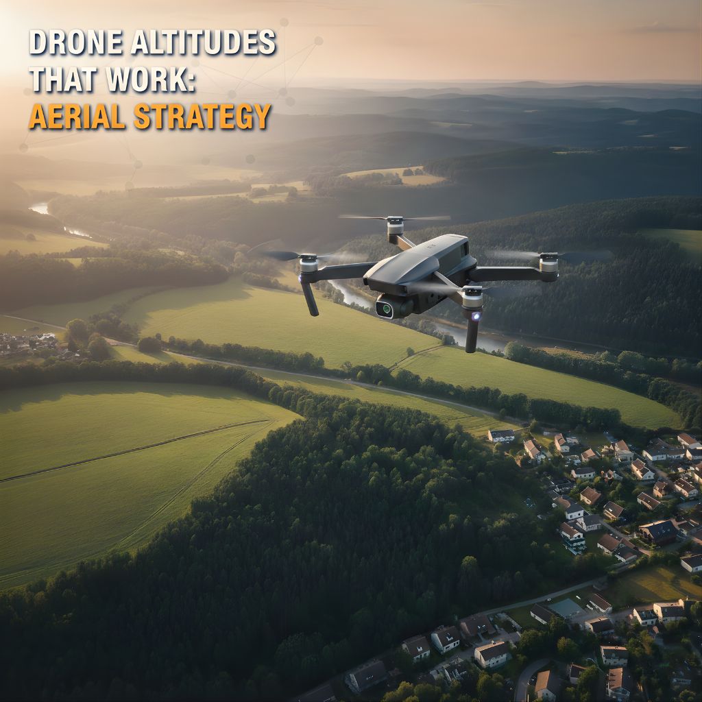
Drone Altitudes That Work: Aerial Strategy in Utah

You’ve probably seen it already:
Two listings both use drone photos
➡️ One looks epic and inviting
➡️ The other looks… kind of flat and forgettable
Same tool. Very different results.
The difference usually isn’t whether you used a drone.
It’s how you used it—and a big part of that is altitude.
In Northern Utah and Southern Idaho, drone photos can be a massive advantage:
Mountain views
Farmland and acreage
New construction neighborhoods
Cul-de-sacs, parks, and open space
But only if those shots actually help buyers understand and feel the property.
This is where aerial strategy comes in—and why choosing the right drone heights for each listing really matters.
Why Drone Altitude Matters More Than You Think
Most buyers don’t consciously say,
“Hmm, this drone shot is too high.”
But they do react to how a listing feels:
“Wow, that yard is bigger than I thought.”
“I love how tucked away that house is.”
“I can’t tell what’s going on around it… next.”
Different altitudes tell different stories:
Too low and it looks like a slightly elevated normal photo.
Too high and it starts to look like a map, not a home.
Just right and buyers get context and connection.
Good drone work is about choosing the height that matches:
The property type
The surroundings
The story you’re trying to tell
A Quick Note on FAA Rules (The Boring Part That Really Matters) ✈️
Before we go any further, it’s important to say this:
Professional drone real estate work isn’t just about pretty pictures—it has to be legal and safe.
In the U.S., that means:
Commercial drone work (like shooting listing photos/video) must be done under FAA Part 107 rules.
Maximum altitude is generally 400 feet above ground level (AGL), unless you’re within 400 feet of a taller structure.
The drone must stay within visual line of sight of the pilot.
Certain areas (near airports, controlled airspace, etc.) may require airspace authorization or may be restricted.
You don’t have to memorize all that as a Realtor—but you do want to know that your media partner takes it seriously.
With DMD Real Estate Photography Utah, you can confidently tell your clients that:
Flights are planned and flown with FAA regulations in mind
We stay within legal altitude limits and local airspace requirements
Safety, compliance, and professionalism come before getting a shot
That way, you’re not just showing beautiful drone views—you’re protecting your reputation and your clients as well.
Altitude #1: Low Aerial (Roughly Roofline to Tree-Top Level)
Think: around roof height up to 20–40 feet
This is your “hero” drone height for many residential listings.
What It’s Great For
Showing off the front elevation with just a little extra drama
Capturing the yard and house together in one frame
Highlighting features like:
RV parking
Big driveways
Corner lots
Front landscaping
In Northern Utah and Southern Idaho, low aerial shots work beautifully for:
Suburban homes in neighborhoods like Logan, Ogden, Layton, Syracuse, etc.
New builds in growing communities
Homes where curb appeal and yard are strong selling points
Low aerial feels familiar but elevated—literally. It still feels like a home you can walk up to, not something tiny on a map.
Altitude #2: Mid-Level Aerial (The “Lot & Layout” Shot)
Think: about 60–120 feet up (still within Part 107 limits)
This is where you start to see the full lot and nearby surroundings clearly.
What It’s Great For
Showing property boundaries more clearly (for marketing, not legal surveys)
Highlighting:
Big backyards
Detached garages or shops
Sheds, play areas, sport courts, outbuildings
Displaying how the home sits on the lot—front-heavy, deep, corner placement, etc.
In Northern Utah & Southern Idaho, this is gold for:
Properties with larger yards or semi-rural feel
Homes near parks, fields, or open space
Listings where the backyard is a major selling point
Mid-level aerial gives buyers that “aha” moment:
“Ohhh, now I see how everything sits and connects.”
Altitude #3: Higher Aerial (Neighborhood & Context)
Think: up to around 200–300 feet (still respecting the 400 ft AGL legal limit and any local airspace restrictions).
This is where the neighborhood story comes in.
What It’s Great For
Showing proximity to:
Parks and playgrounds
Schools
Trails and canyons
Fields, farms, or open space
Giving out-of-area buyers a feel for:
Density
Street layout
Surrounding environment
In Northern Utah and Southern Idaho, higher aerial is especially useful for:
New construction communities
Homes near canyons, lakes, or mountain views
Semi-rural properties where you want to show access and space
The key is not to drift into “satellite view” territory. The home should still feel like the star of the photo—not a tiny dot in the distance.
When Lower Is Better (And When Higher Hurts You)
Just because you can go higher (within FAA limits) doesn’t mean you should.
Lower Is Better When…
The house itself has strong curb appeal
The neighborhood is fairly dense and you don’t want to highlight how close everything is
You want a more emotional, “homey” feel instead of a technical overview
Higher Can Hurt When…
There’s a busy road nearby you don’t want front and center
Nearby properties are cluttered, under construction, or visually distracting
The home looks tiny and insignificant from the height you’re flying
A smart drone strategy sometimes means choosing a lower altitude that better serves the listing’s story.
Acreage & Rural Utah: A Different Altitude Mix
For acreage and rural properties around places like:
Cache Valley
Tremonton
Brigham City outskirts
Southern Idaho communities
…altitude strategy changes a bit.
You Usually Want:
Mid to higher shots that:
Show land size and layout
Capture barns, shops, corrals, and outbuildings in one view
Give buyers a realistic sense of scope
Closer, low-altitude shots that:
Still show the home + immediate yard where people actually live and gather
Buyers considering acreage aren’t just buying a house—they’re buying space. The right altitudes help them understand whether that space matches what they’re hoping for.
Putting It All Together: Story, Not Just Height
A strong drone sequence for a Utah listing might include:
Low front-angle shot – House + yard + driveway
Mid-level lot shot – House + full lot + nearest neighbors
Higher neighborhood shot – Home + surrounding area, park, foothills, or open space
Together, they answer:
What does it feel like to arrive here?
How much space do we actually have?
What’s around us?
That’s the kind of clarity that helps buyers feel confident booking a showing—and writing offers.
How DMD Real Estate Photography Utah Handles Drone & FAA Compliance
At DMD Real Estate Photography Utah, we treat drone work as professional aviation + media, not just “cool tech.”
That means:
We fly under FAA Part 107 rules for commercial operations
We respect 400 ft AGL altitude limits and line-of-sight requirements
We check airspace and conditions before flying (especially near airports or controlled airspace)
Safety and compliance come first—then creativity and storytelling
For you as the Realtor, that translates to:
Peace of mind that your listing media is captured legally and safely
Confidence if a client or another agent asks, “Is this allowed?”
A better experience for everyone at the property during the shoot
How to Talk About This with Sellers
Sellers love hearing there’s both strategy and safety behind the visuals.
You might say something like:
“We use professional drone work with DMD Real Estate Photography Utah. They fly under FAA rules, stay within legal altitude limits, and choose drone heights that show your yard, lot, and neighborhood in the best and most accurate way.”
It sounds thoughtful, compliant, and high-end—because it is.
Final Thought: Drone Is a Tool—Strategy Is the Advantage
Drone is everywhere now. What actually sets you apart is:
Using the right altitudes for the right property
Working with a legal, Part 107-compliant drone team
Combining drone with:
Great ground photos
Video walkthroughs
Floor plans or 3D tours when appropriate
That’s how you go from “We have drone pics” to:
“Our marketing gives buyers a complete picture of your home—ground, sky, and everything in between.”
Ready to Add Smart, Compliant Drone Strategy to Your Utah Listings?
If you’re a Realtor in Northern Utah or Southern Idaho and want drone photos and video that are:
Strategic
Beautiful
FAA-compliant
…we’d love to help.
➡️ Book Your Next Drone-Enhanced Listing Shoot with DMD Real Estate Photography Utah
We’ll handle the altitudes, angles, and FAA rules while you focus on what you do best: taking care of your clients. 🚁🏡✨
